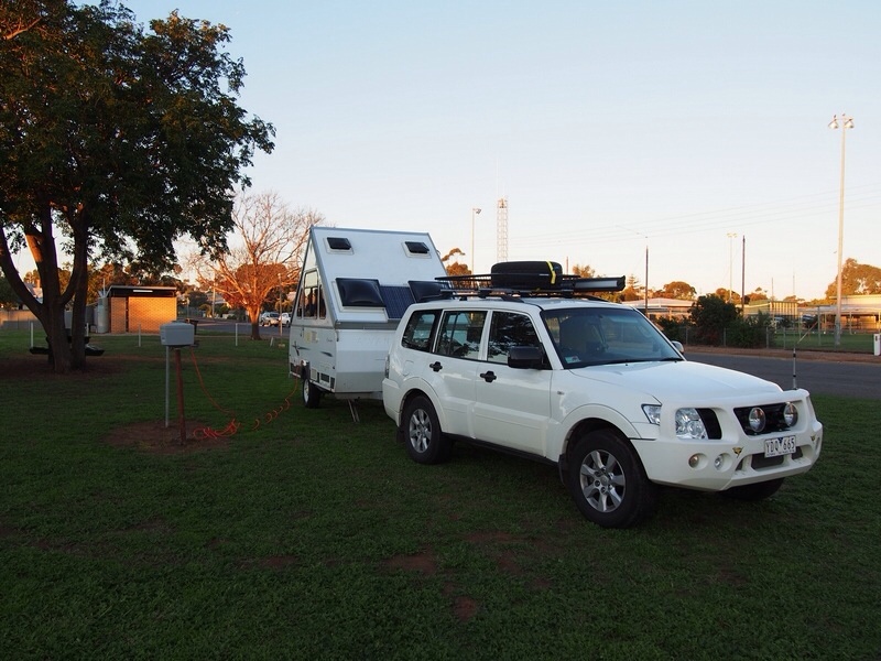
2 June 2014: Templestowe to Woomelang, 410 km
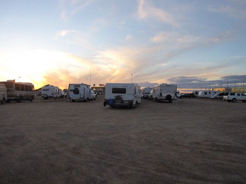
It was foggy and 12 degrees C when we left home just before 0900. But by the time we reached Creswick for morning tea with Leonie (Greg’s sister) the sun was shining. We then took country roads through the goldfields area before joining up with the Sunraysia Highway at Avoca. Everything was nice and green as we headed north through sheep and wheat country. Through Wikicamps app we found an excellent free camping site at Woomelang for our first night – with power, toilets and hot shower!
Woomelang campsite
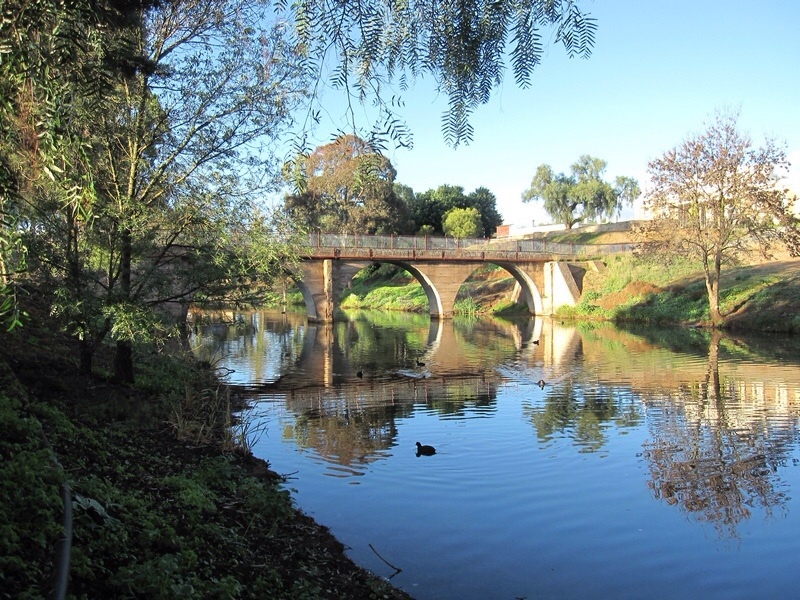
3 June 2014: Woomelang to Burra, 536 km
Travelled via Mildura, Renmark and Morgan to arrive in Burra late afternoon. We got to the fruit-fly exclusion zone in Victoria earlier than expected, so ate all our remaining fruit for morning tea. Stocked up again over the border in Renmark. We had a beautiful campsite in Burra with a river frontage.
View from our campsite at Burra
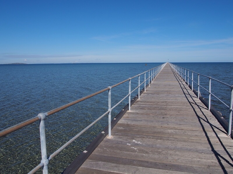
4 June 2014: Burra to Pimba, 392 km
It was cold overnight (4 degrees C) but we were snug with our hot-water bottles in their African covers (courtesy of Glenn and Lucy). Stopped in Gladstone (largest inland grain storing town in Southern Hemisphere) for morning tea. Then on to Port Germein, which boasts the longest wooden jetty in Australia – at one time it was 1.7 km long and Port Germein was the largest grain shipping port in Australia.
Port Germein jetty
We filled up with diesel in Port Augusta then headed north along the Stuart Highway towards Woomera. We stopped for the night at a pretty desolate (but free) campsite at Pimba.
Pimba campsite
5 June 2014: Pimba to Coober Pedy, 392 km
We had an easy drive from Pimba to Coober Pedy, arriving early afternoon at the Opal Inn Caravan Park. Spent the afternoon exploring Coober Pedy – it felt a bit like a scene out of Star Wars.
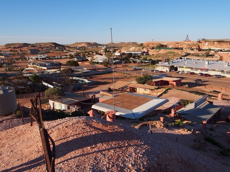
Overlooking Coober Pedy
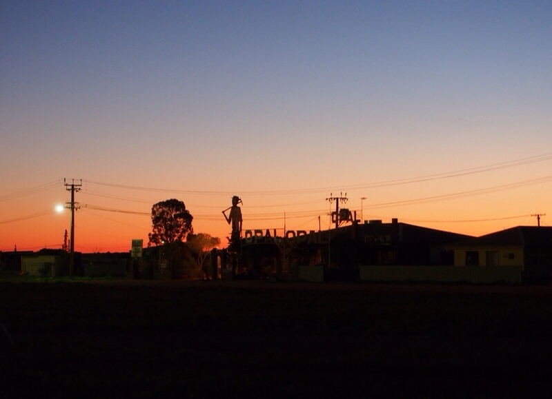
Sunset at Coober Pedy
6 June 2014: Coober Pedy to the border, 404 km
Filled up with diesel and water then headed off towards the NT border. We got a chip in the windscreen thanks to a stone thrown up by a road train. Audio books help to make the time go faster. We listened to A Fortunate Life by AB Facey as we drove along – a great story so far. Stayed the night at a free campsite, right on the border. The caravan was in SA, the toilet in NT – the first time we’ve had to go interstate to go to the toilet!

Overnight stop on the SA/NT border
7 June 2014: NT Border to Alice Springs, 357 km
We had a quick trip to Alice Springs, arriving around noon. The landscape has changed from mostly flat to rocky outcrops. We found a caravan park on the other side of the city centre and decided to stay for two nights. Emily and Jessie Gaps were the highlights of the afternoon. It was wonderful to see little green and yellow budgerigars flitting around in their natural habitat.

Magnificent rocks at Emily Gap …
… and at Jessie Gap
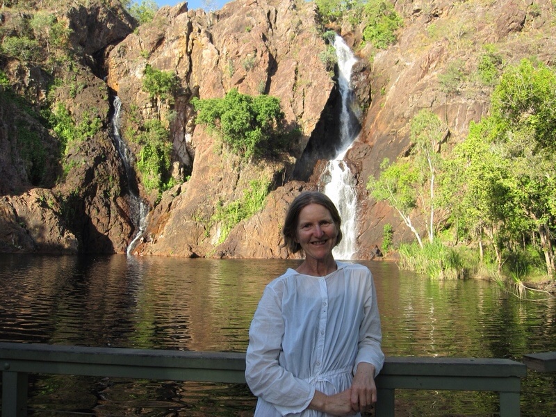
8 June 2014: Alice Springs, 316 km
A gorgeous and chasmatic day for Greg’s birthday. First stop, after a quick dash through the Todd Mall Market, was Simpson’s Gap. Then on to Standley Chasm which is reportedly best seen at midday when the effect of the overhead sun on the chasm walls is particularly striking. We expected swarms of people to be there but as luck would have it (or perhaps thanks to the lure of the Finke Motorbike Races) we had the place to ourselves for a few brief minutes right at the magical time. The third stop was Ormiston Gorge, another very special place with lots of water, beautiful ghost gums and lots of little flowers.

Standley Chasm at midday
13 June 2014, Alice Springs to Katherine, 948 km
We’ve been out of Internet range for the last few days, so this is a catch-up. Our first stop after Alice was Devil’s Marbles, a collection of huge granite boulders scattered over several square kilometres. The colours of the rocks changed as the sun went down and again at sunrise.

Devil’s Marbles at sunset
Next night we stayed at a roadside stop at Newcastle Waters. From then on the vegetation became more lush and the roadkill more plentiful!
Daly Waters was the next stop. We planned to pull in for morning tea only, but ended up staying the night. It’s a fascinating place – in the middle of nowhere, but apparently the site of the first hotel in the Northern Territory and also Australia’s first international airport! The camping ground, next to the pub, was virtually empty when we arrived but completely packed by late afternoon. A ‘barra and beef’ dinner is the house specialty of the pub and had lots of takers.
John Stuart, the first white explorer to cross Australia from south to north, left Daly Waters on 11 June 1862 for his final push north. We did a short historical walk outlining his journey and realised that it was exactly 152 years later that we were treading the same ground.
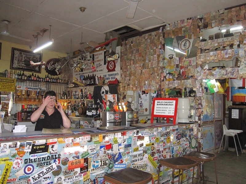
Daly Waters pub
We camped the next night at Elsey National Park on the Roper River near Mataranka. The highlight here was a swim in the warm water (34 degrees C) of Bitter Springs. About 30 million litres of water flows from the springs into the Roper River each day. Another really nice thing about the national park was the abundance of space, after having been cramped in with so many other vans on many of our stops so far.
Today we travelled up to Katherine and we’re staying in a super luxurious (by our standards) caravan park a little out of town. It’s slowly getting warmer (32 degrees C today), so a leisurely swim in the park pool was very welcome. A sign in the bathrooms says: ‘Please turn out the lights after use. Lights attract bugs. Bugs attract toads. Toads are messy’. A sign perhaps of things to come!
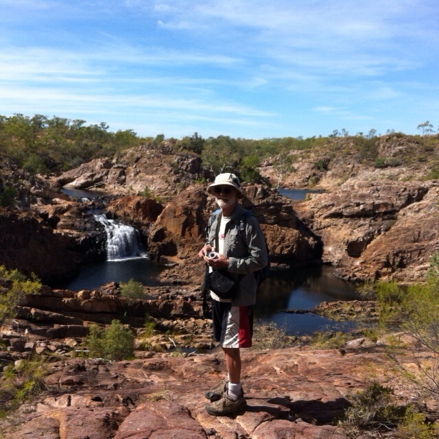
14 June 2014: Katherine Gorge, 63 km
We headed off early this morning to beat the heat and did the Baruwei Loop Walk at Katherine Gorge. The walk was only 3.7 km but we saw some lovely wildflowers and had a good view of the gorge from the escarpment. Hundreds of noisy fruit bats were in the trees beside the river.
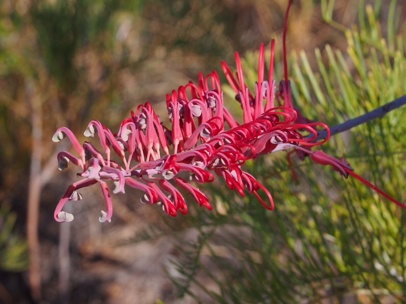
Grevillea at Katherine Gorge
15 June – 21 June 2014: Kakadu
Our plans to meet Celia in Gunlom were slightly thwarted when we found, at the Mary River Roadhouse, that the road to Gunlom was closed to regular caravans (off-road was OK). So, plan B was to park the van at Gungurul, about 30 km past the Gunlom turnoff, and drive in from there (about 70 km each way). The road in was quite corrugated and parts had been washed away in the wet season so we thought we had probably made the right decision not to attempt it. We finally arrived mid-afternoon and it was terrific to meet up with Celia and Rolf and our two great-nephews William and Joshua, and also Rolf’s sister Karen and her family who had travelled from Melbourne via WA.
Gunlom is a beautiful spot with a large waterhole that is close to the campground and good for swimming and canoeing. This is fed by a waterfall at the top of an escarpment. On the Monday we drove back in early and climbed up with the others to the top of the escarpment where there is a series of beautiful pools. This was one of the real highlights of our trip to Kakadu.
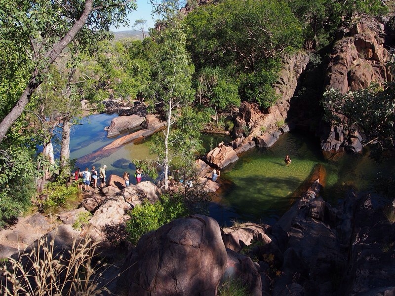
Gunlom pools
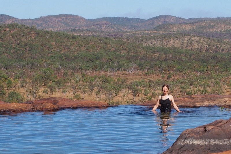
The ‘ultimate’ infinity pool
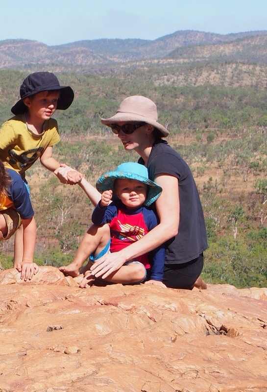
Rock-hoppers Will, Josh and Celia
We spent another night at Gungurul, then made our way north to Mardugal for three nights and on to Jabiru for two. We used these spots as our bases and did day trips from them. Highlights were:
- a swim at Maguk with just the fish for company
- a guided walk near the Mardugal campground with Violet Lawson, a local Aboriginal woman (who showed us, among other things, how to make string from native palm leaves)
- the walk into Jim Jim Falls over spectacular rocks and a swim in the beach pool. The drive in is about 60 km from the Stuart Highway on an unsealed road, which was fine until about the last 10 km. It became clear why the map suggests that should allow 2 hours to travel one way!
- a sunset cruise on Yellow Waters and the South Alligator River – thankfully the only crocodiles we saw were from the safety of the cruise boat
- the rock art at Nourlangie and a guided walk with one of the park rangers who explained a lot about Aboriginal law and culture and their strong association with the land
- a sunset walk at Ubirr with an Aboriginal ranger, who showed us the rock art and told wonderful dreamtime stories
- the view from the top of the rocks at Ubirr across the East Alligator River and over to Arnhem Land as the sun set.

Maguk

Setting sun on the Yellow Waters Cruise
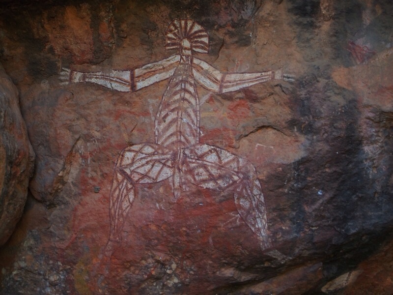
Rock art at Nourlangie
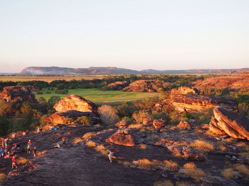
Ubirr at dusk
22 June to 28 June: Darwin
Darwin was great fun. We stayed for 6 nights with Celia, Rolf, Will and Josh and were thoroughly spoilt. Celia’s unit in the front garden of their house was absolute luxury after camping. Many thanks to them for their wonderful hospitality.
It was also terrific to have Rolf’s expert advice on places to try for all our maintenance needs. These included 4 new tyres (more off-road than standard), a new weight distribution system to balance the load between the car and the van, and a new water filter (NT water is hard and tends to precipitate).
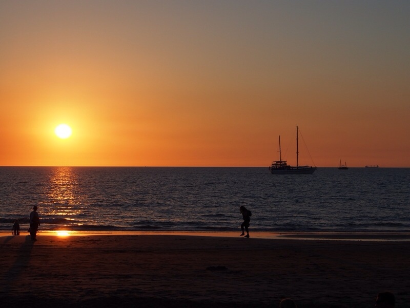
The weather in Darwin at this time of year is very pleasant and everyone seems to make the most of it. We ate outside every night, a couple of times down on the beach watching the sunset. There were no mosquitoes or other bugs as we had expected.
28 June to 1 July: Litchfield National Park
We left Darwin about midday on Saturday, had lunch in Batchelor and stayed the night at the Pandanus Campground just short of the national park. This meant we arrived at the Wangi campground nice and early on Sunday morning and got a good campsite. [Wangi is the only campsite in the park that is suitable for caravans and we’d heard that it fills up early, which proved to be correct.]
This is another beautiful location with a large rockpool and waterfalls. It was a great place to cool off in the heat of the day. There is a short walk to a lookout and a longer loop walk above the falls which we did later in the afternoon and then cooled off again with another swim.
Jenny at Wangi Falls

Loop walk above the Wangi Falls
There are other great places to visit in the park and we fitted in as much as we could on Monday. First stop was the Tolmer Lookout, an impressive canyon that must have a spectacular waterfall in the wet season. We found the loop walk back to the carpark more interesting – the burnt-out cycad area was like being on a different planet.
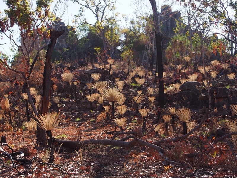
Cycads regenerating after fire
We then went on to Buley Rockhole (a series of small waterfalls and rockholes) and Florence Falls (a spectacular double waterfall with plunge pool at the bottom). We swam in both places and did the walk along Florence Creek which connects the two. Both were fantastic.

Buley Rockhole

Florence Falls
1 to 3 July 2014: Litchfield to Leliyn
On our way out of Litchfield we stopped at the Magnetic Termite Mounds. These mounds are made by a termite that can detect the magnetic field of the Earth and align their mounds accordingly. This means that one side of the mound is always in the shade and so does not overheat. A boardwalk just off the road looks out onto hundreds of these mounds – it looked like a graveyard.
We arrived at Leliyn (or Edith Falls) mid-afternoon. Many places in the Northern Territory have two names – the Aboriginal name and an English version (with the English name to be phased out over time). Leliyn is a pretty campground with an inner grassed area and vans/tents around the perimeter. There’s a refreshingly cool waterhole at the base of the falls just a short walk from the campground. There are a couple of longer walks – the next morning we did the 2.6 km loop walk and swam in the upper pool. We discovered that we had mobile reception at the top of the escarpment so climbed up again in the afternoon to download The Age.
Greg at upper pools, Leliyn
3 to 5 July 2014: Katherine
We returned to Katherine to stock up on supplies and to do some washing before heading west. We stayed again at the Shady Lane Campground. On Friday morning we drove into the Nitmiluk National Park and Katherine Gorge and did the 12 km Butterfly Gorge Walk, so named because of the butterflies that inhabit the rainforest towards the end of the walk. It was hot and dusty with no easy access to the water at the end so we decided against swimming.
5 and 6 July 2014: Gregory National Park
The road from Katherine to Kununurra passes through the Gregory National Park (obviously named after a very important person!). The eastern section comprises rugged red escarpments and dry savannah woodland. As we moved into the western section the statuesque boab trees started to appear. These come in all shapes and sizes – some squat and dumpy, others tall and slender. Some are in splendid isolation while others are clustered together in family groups.
We camped for the night at Fogarty’s Campground in Timber Creek. At 5.00 pm the daily kite and freshwater crocodile feeding took place. These crocodiles are somewhat more subdued than their estuarine cousins.
The Gregory Tree is about 9 km west of Timber Creek. It marks the base for the expedition led by Augustus Charles Gregory in 1855 to 1856. Carved into the tree are the dates when the expedition arrived and departed.

Greg in the eastern section of the Gregory National Park
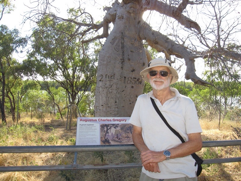
Greg with his boab tree (the Gregory Tree)
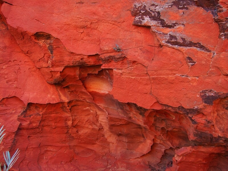
6 to 8 July 2014: Kununurra
Kununurra is the gateway to the Gibb River Road. It’s a fairly quiet little town built around the Ord River Project. We stayed in the Hidden Valley Caravan Park, which backs onto the Mirima National Park – a sort of baby Bungles with vivid colouring, especially at sunset. We have seen so many beautiful red rocks on this trip that we should be getting used to them by now. But the colour is so intense that it stops us in our tracks every time.
Rocks at sunset in the Mirima National Park, Kununurra
